the wandering chick
I'm not sure how many times we said, "There are no words to describe the beauty." Probably once every hour, for six days.
A travel partner and I planned a spring trip to journey through the Grand Staircase-Escalante National Monument and continuing on through Capitol Reef National Park. We planned for four overnights. We ended up extending to five.
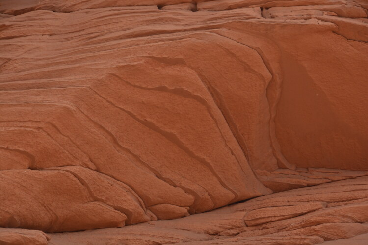
Each day was a new area, driving from Phoenix to Page, Arizona, on Day One where we did a wonderful hike across the red slickrock.
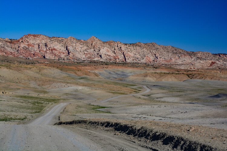
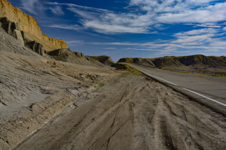
On Day Two we headed into Utah, driving the gravel-packed Cottonwood Canyon Road, a 46-mile road from Utah's Highway 89 to Bryce Canyon National Park. It was the beginning of the Grand Staircase.
Days Three, Four and Five took us from Bryce to Hanksville, where we would spend more time and energy in the Grand Staircase, visiting three slot canyons, Devil's Garden, Goblin Valley State Park and then into Capitol Reef National Monument.
On Day Six we headed home, but not without stopping for photos at the continued scenic vistas.
Our stops along the highways were numerous. Traffic was light, so we had great opportunities to pull over for photos...sometimes in designated spots, most of the times not.
We counted four highlights to the trip: the Beehive hike in Page; the Little Wild Horse slot canyon; Devil's Garden and the scenic drive all the way from Page to beyond Hanksville. Incredible scenery and so different from one area to the next.
The photos will not do it justice, but hopefully it will give viewers incentive to make the journey themselves. They also will be saying, "There are no words to describe the beauty."
...the Grand Staircase-Escalante
a six-day journey
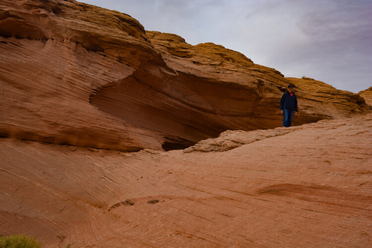
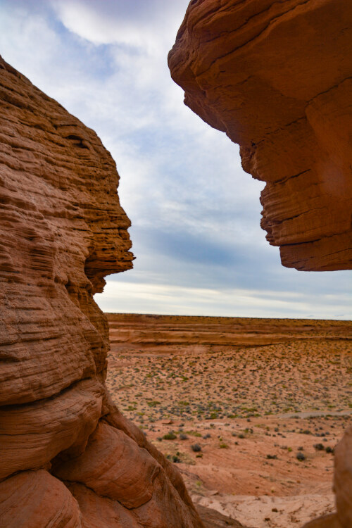
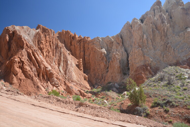
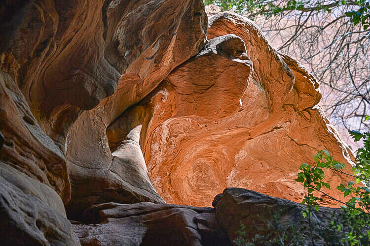
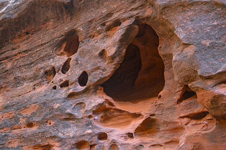
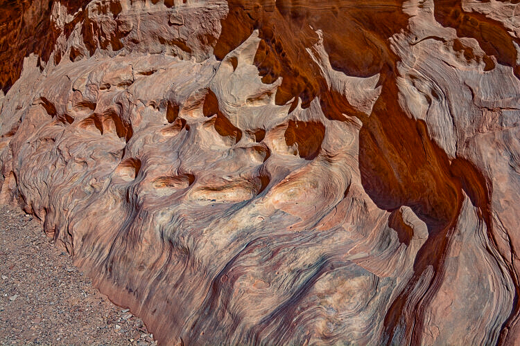
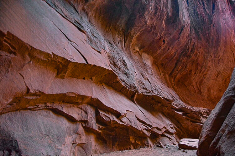
Gaining lots of attention in Page is what is called Biidi the Arch, but informally known as the Sand Cave or the Shell Cave. Located behind the Shell Station at the north end of the Coppermine Road, we were deceived, looking for an arch. It's more of a cave, actually. Pictures seen of the "arch" were evidently taken with a very wide-angle camera lens from the inside looking out. At any rate, it's interesting and fun to venture in. The texture of the walls is pretty astonishing.
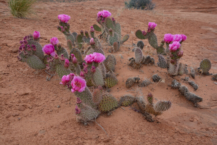
Prickly pear in bloom
Those with a little adventure in their bones would love the "shortcut" to Bryce Canyon National Park from the south, i.e. the Page area. Cottonwood Canyon Road is a gravel-packed 46-mile scenic road that had us pulling over for photos at every mile. High-clearance vehicles are recommended, but the road -- in dry conditions -- is well-maintained and fairly free of large rocks, washboard travel and traffic. Please note: check the weather forecast for rain before taking this road. Curves and steep grades don't mix with wet roads.
The photo above left is on the Mossy Cave Trail, within the Grand Staircase and near the town of Tropic. Above is the Mossy Cave. A small viewing section and, frankly, not that exciting, it was probably our only disappointment of the whole trip. A waterfall, which is on the same trail, was not much more than a dribble.
The Cottonwood Canyon Road travels north and south, and at the north end is a panoramic view of Kodachrome Basin, seen here.
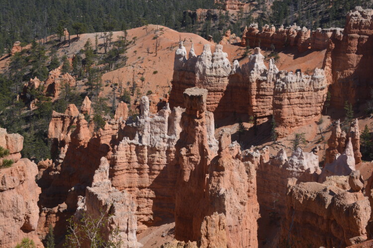
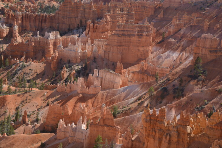
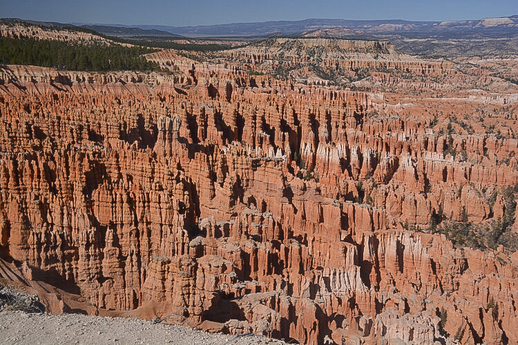
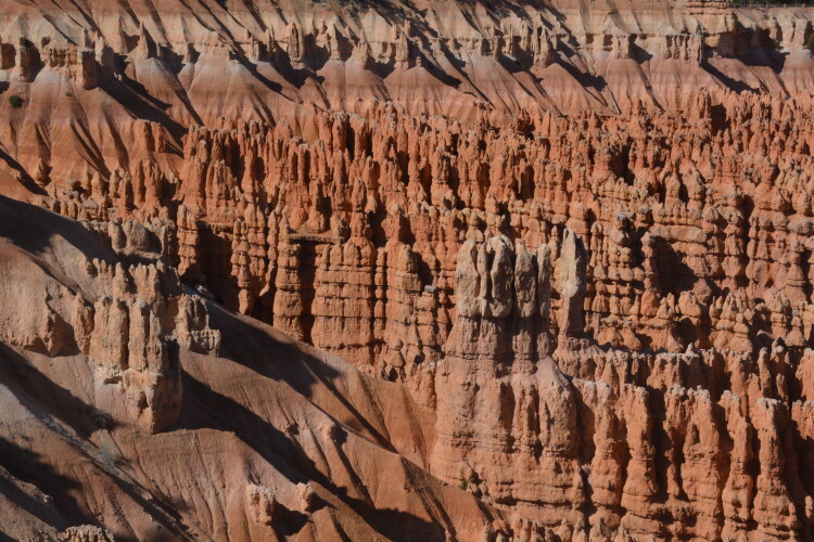
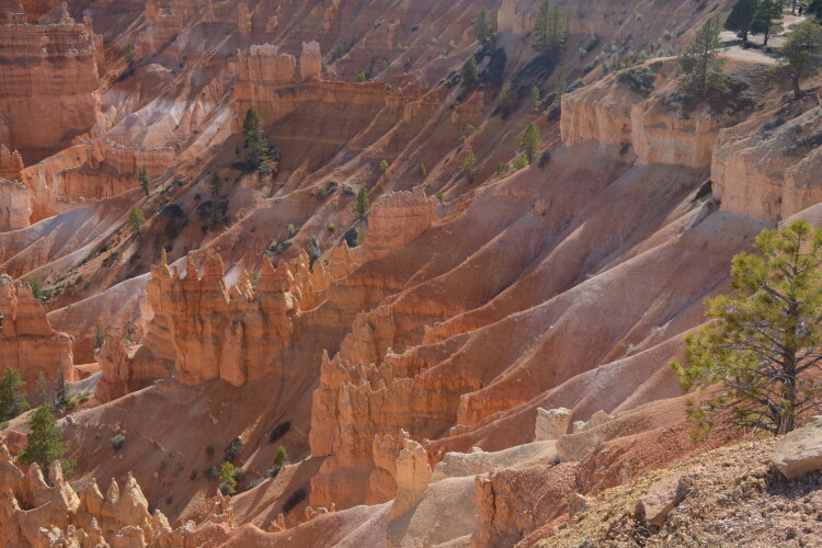
Sunrise Point, Sunset Point and Inspiration Point offer excellent views of the hoodoos. There are other points as well along the rim.
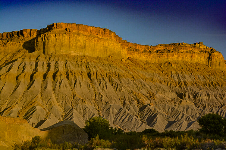
Bryce Canyon National Park offers rock formations that are different from any other Utah national park. They're called hoodoos and they're prominent throughout the park. The rim of Bryce Canyon offers several pullouts with large parking lots. The walks over to the edge to look down upon the hoodoos are short ones, albiet sometimes up a paved path. Trails down into the hoodoos are numerous.
The Silent City. Here, at Inspiration Point, the hoodoos stand speechless, motionless, together in support of each other, like bonded citizens. Some say they stand tall and erect, like soldiers in an army.
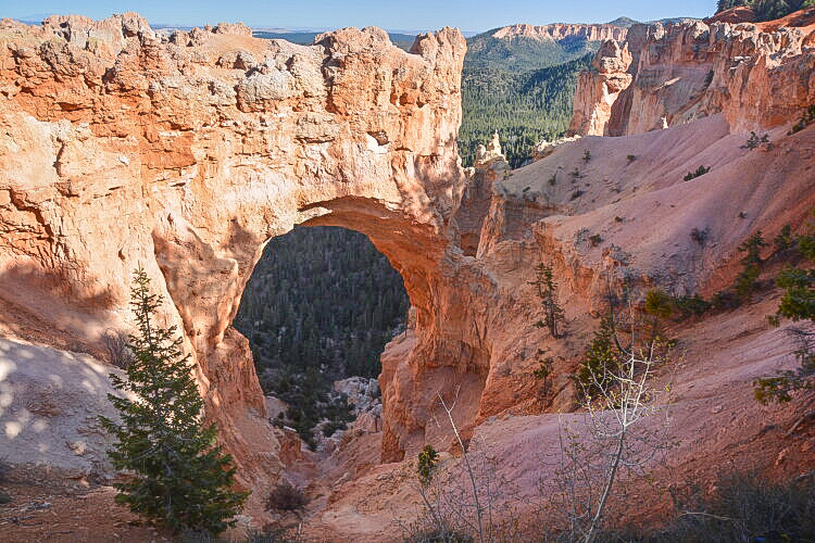
A view of Natural Bridge
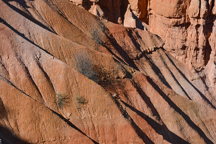
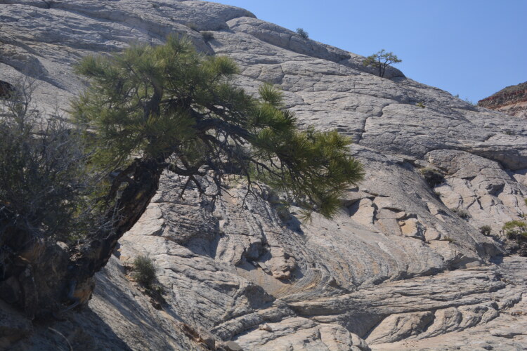
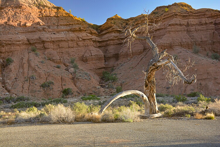
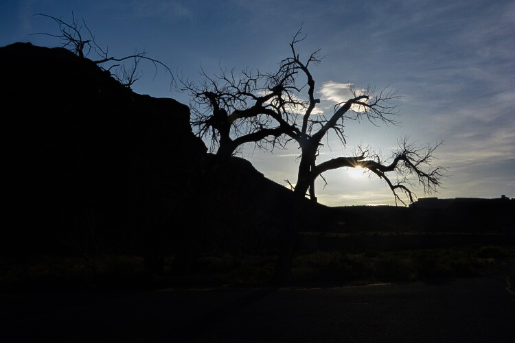
If I had a nickle for every tree I wanted to take a picture of, I'd be a rich person. The Utah Junipers are most common in much of Utah and are identified by their twisty gnarled trunks. They often appear dead and are drought-tolerant.
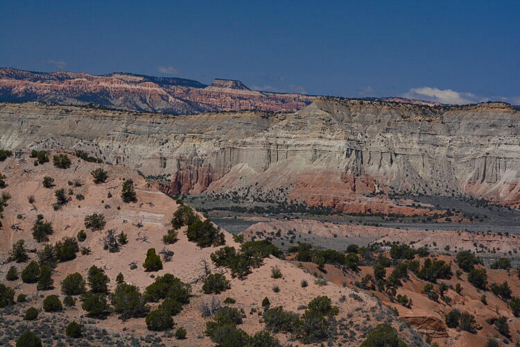
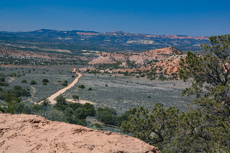
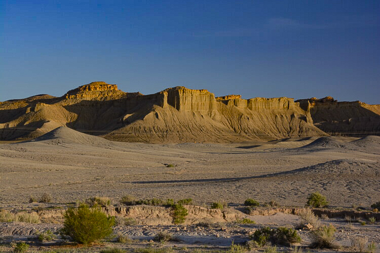
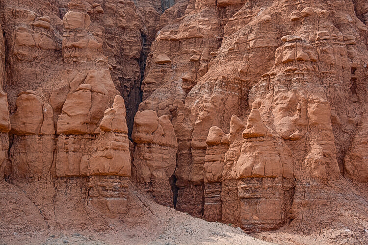
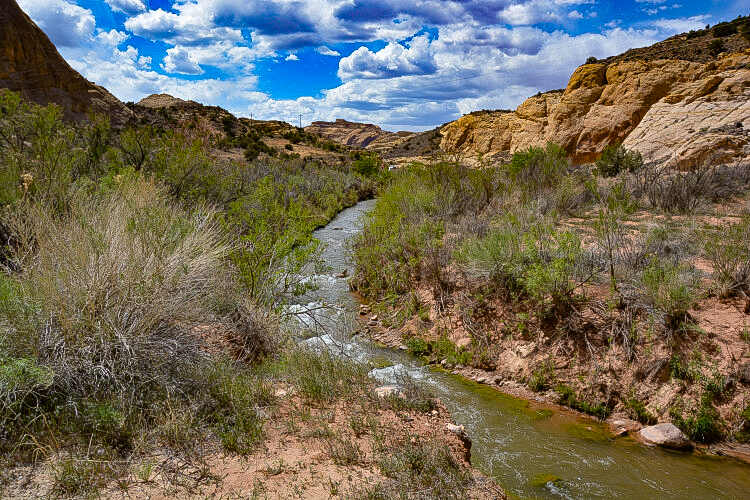
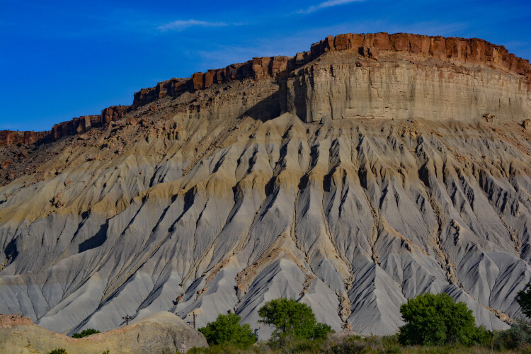
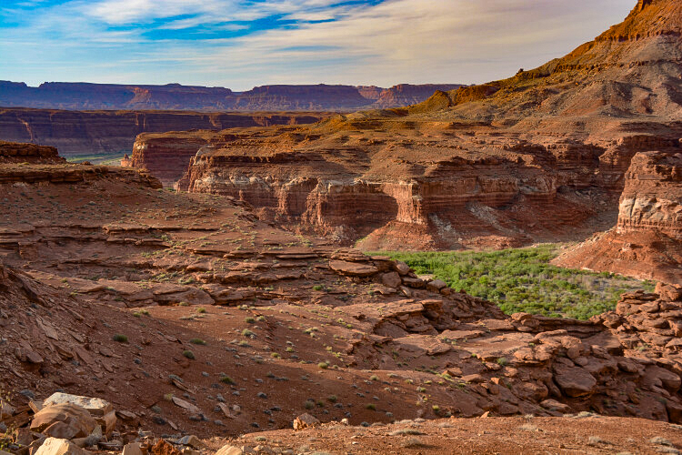
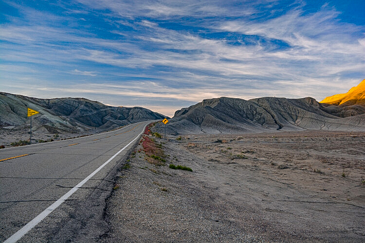
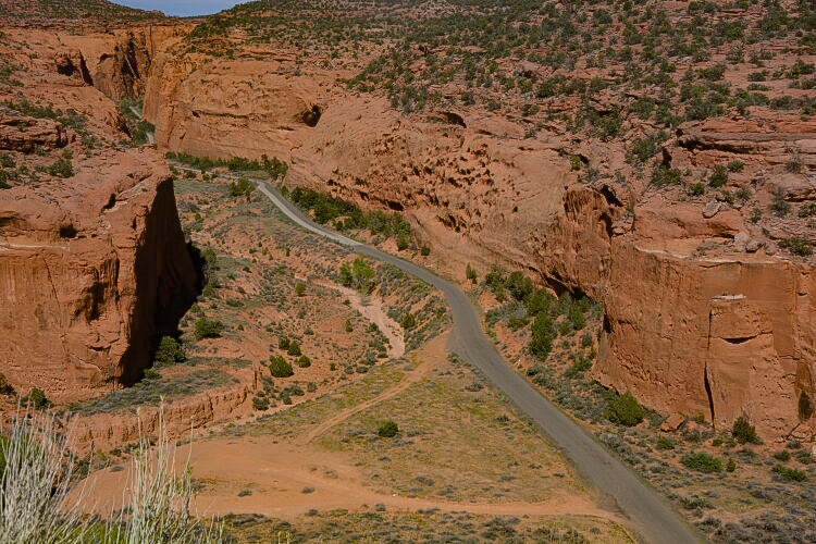
Here's where we get into the heart of the Grand Staircase-Escalante. High on an overlook, we can see the road, Highway 12, between Escalante and Torrey, as it meanders through the colorful rock formations, caves and massive walls.

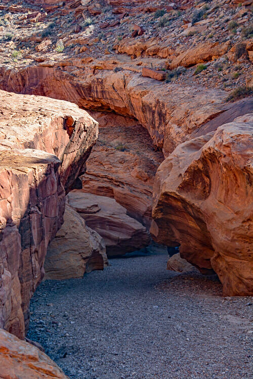
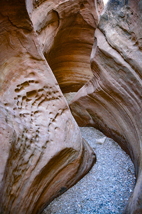
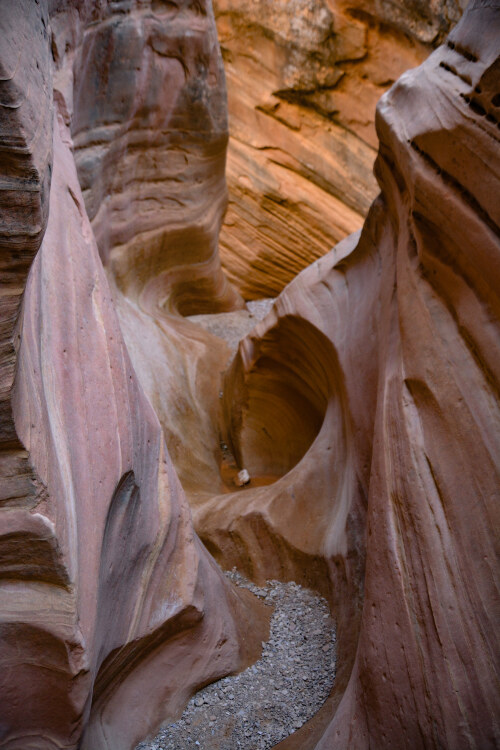
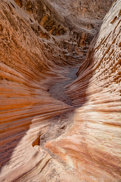
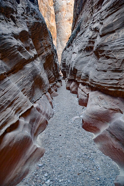
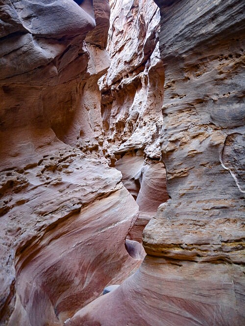
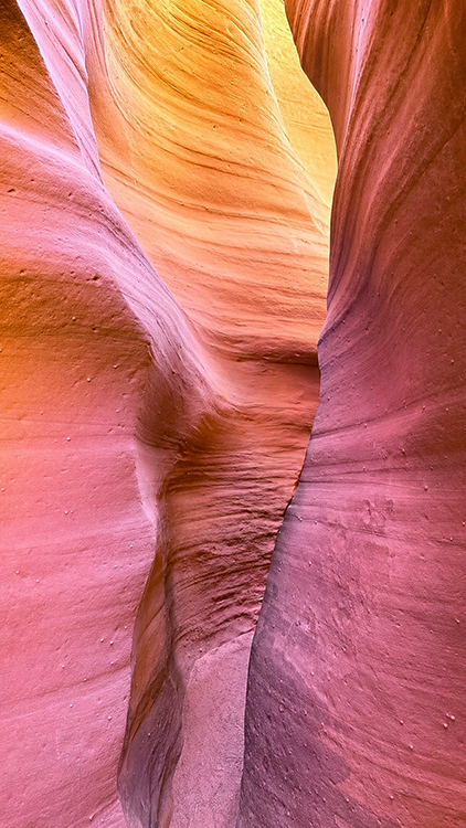
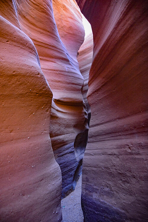
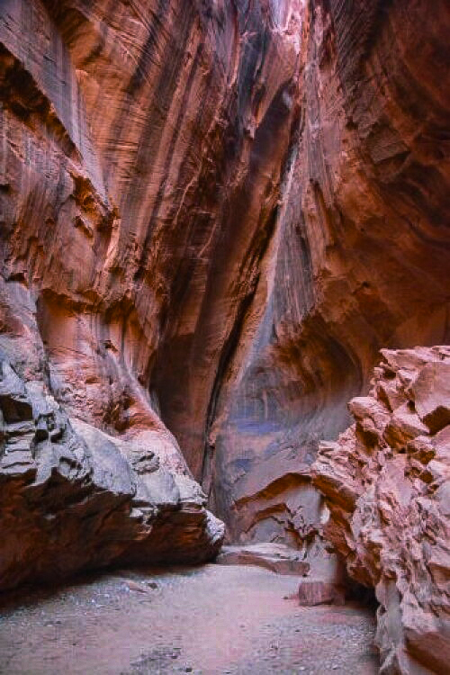
To understand how slot canyons are formed, one has to first imagine the power of water.
In simple terms, a slot may start with a small crevice in a rock wall; over millions of years, flood water rushes into the crevice, carrying with it sand, gravel, rocks and debris, widening the crack each time, wearing away the walls as it pounds into them. As the water is trapped in the crevice, it sloshes around, constantly and at random wearing away the soft sandstone and widening it to the point where one can actually walk into what was once just a crack.
Each time a flood occurs, the slot is changed. Most often, the flood comes crashing in not in terms of inches, but feet. What might be a normal rain outside a slot will most likely be a fast, furious surge of tens of feet or more in the narrow passageways of a slot canyon.
Slots are most common in the southwest where flash flooding occurs in fast, torrential downpours. It's advised to always check for potential rain that might be even miles away upstream before entering a slot canyon.
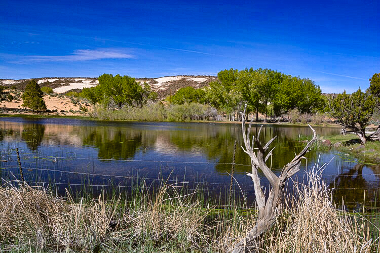
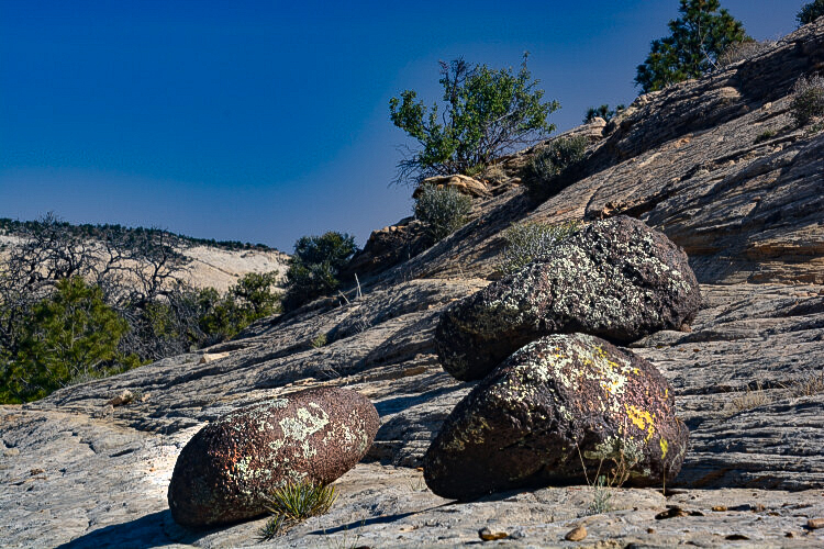
Soon after leaving Burr Trail Road and getting back on to Highway 12, we find this serene little pond. Across the street from it was a massive pile of sliprock on which was scattered large black volcanic rocks. Sliprock is so easy to navigate, we spent a little time checking it out.
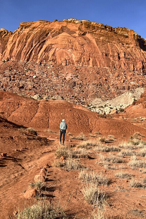
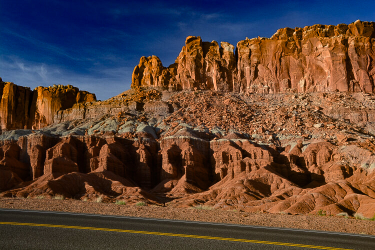
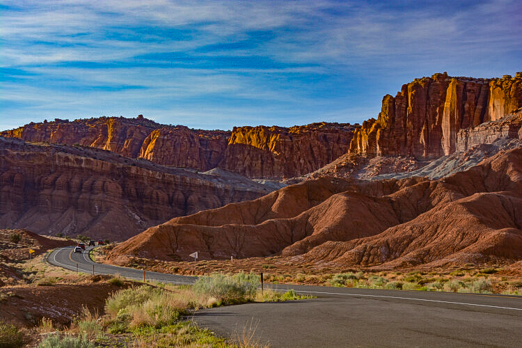
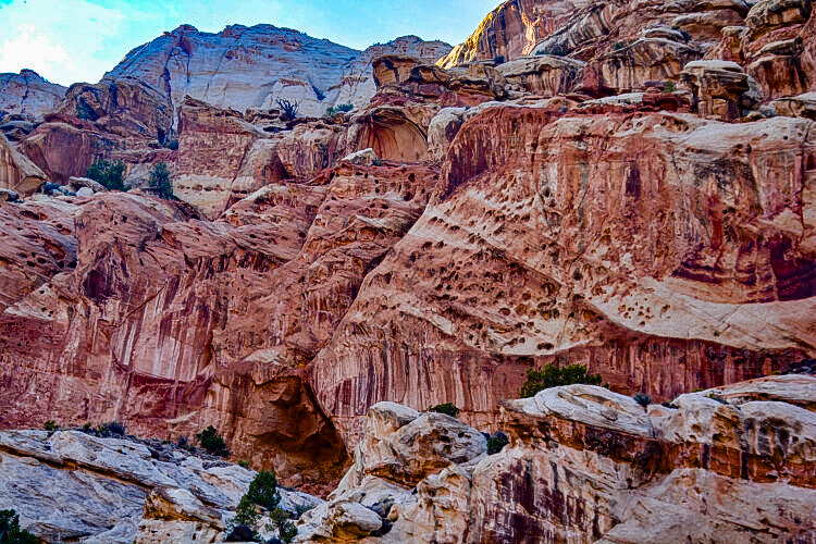
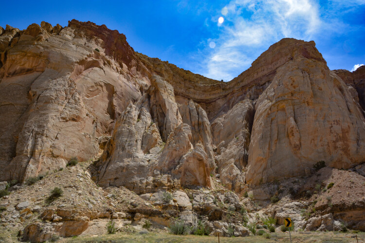
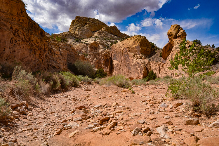
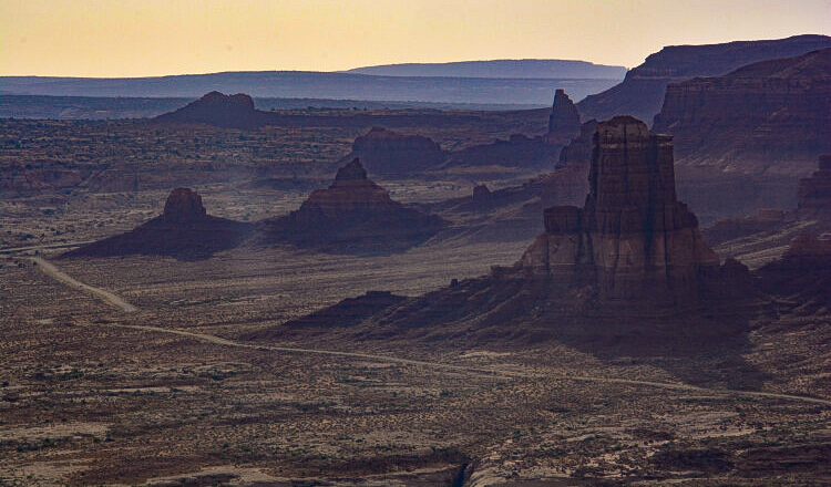
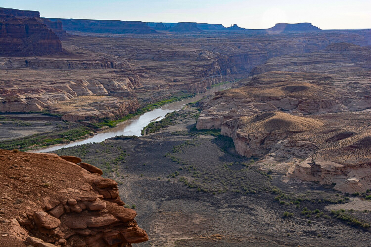
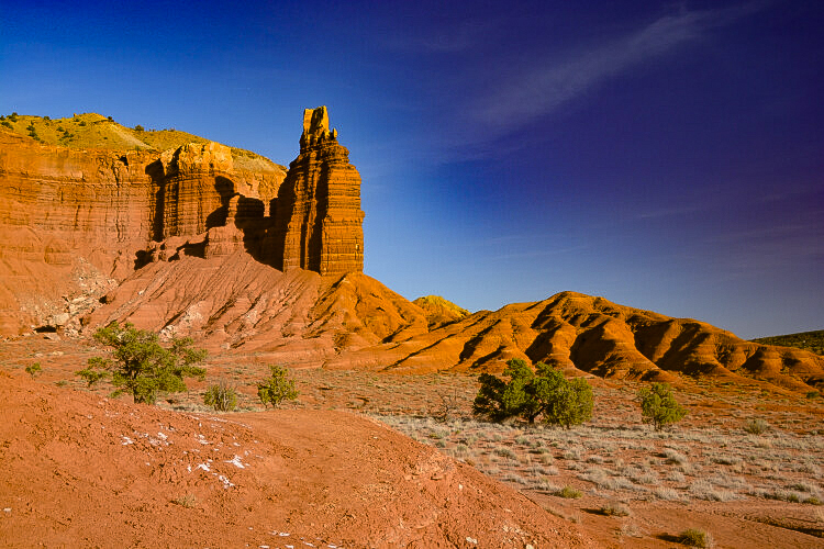
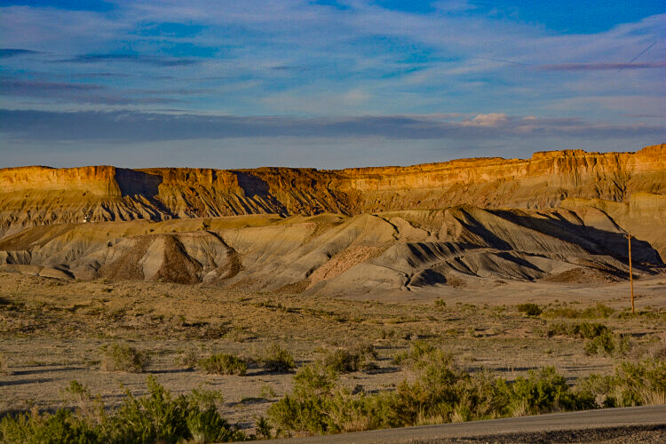
We've finally made the trek from Bryce to Torrey, only a distance of 127 milles, an easy 4 hours. It took us 8, finally getting into Torrey a little after 5pm. It was here we got on to yet another scenic byway, Utah State Highwy 24, that leads from Torrey to Hanksville. For the next few miles, we will be itraveling through Capitol Reef National Park, seen here in the distance. Capitol Reef's landscape is that of canyons, rugged cliffs and colorful rock formations.
Photo by my travel partner, K.A.
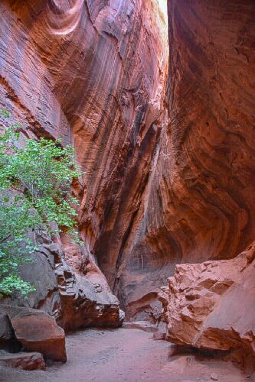
Leaving Long Canyon slot
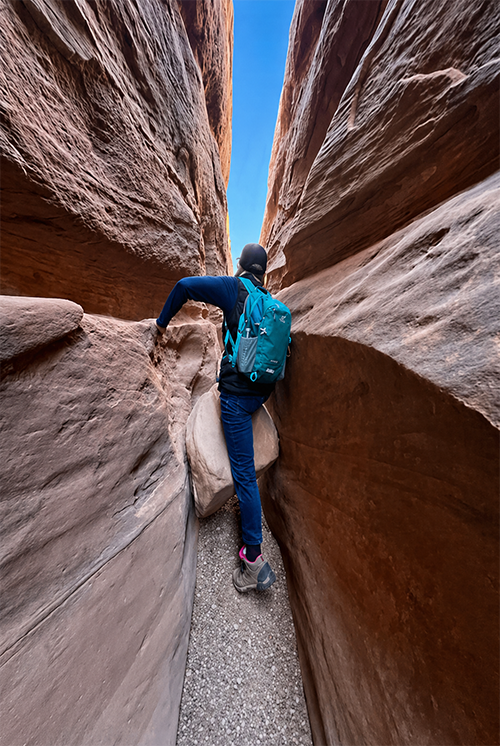
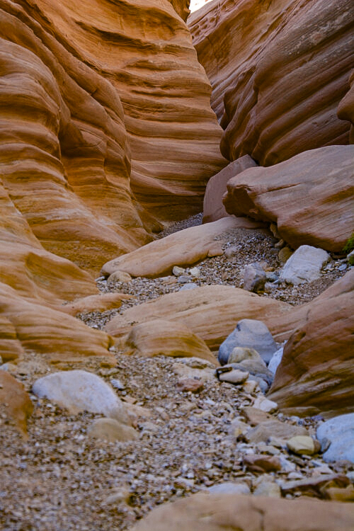
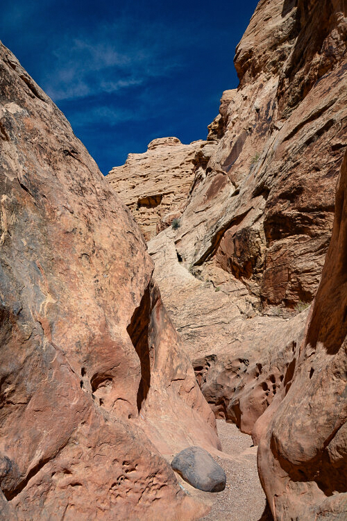
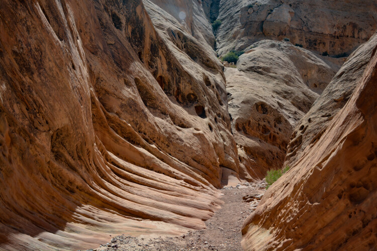
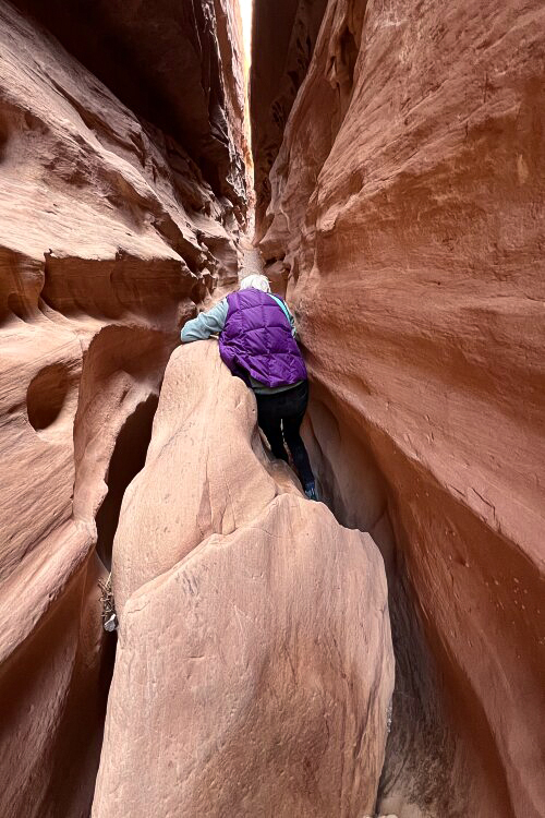
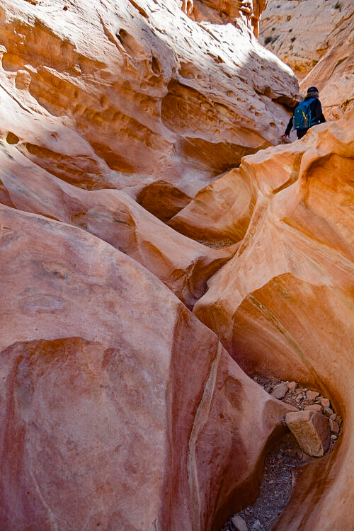
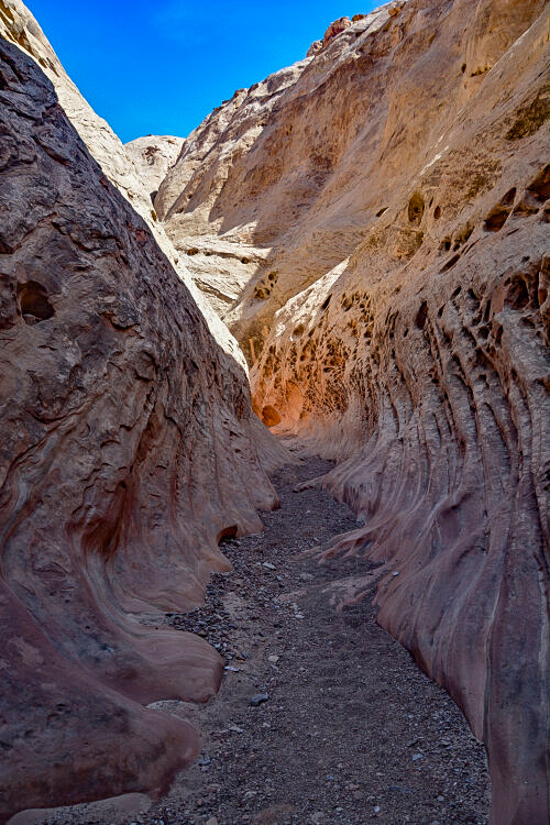
Our most daring adventure was Little Wild Horse slot canyon. Holy smokes! Not being avid, super adventurous hikers of slot canyons, this was a head-banger for us. In more ways than one! Very challenging, trying to find the best steps for scrambling over, under and around boulders. Thrilling? Yes! Little Wild Horse slot is located north of Hanksville, just off Utah State Highway 95, very near Goblin Valley State Park.
Little Wild Horse slot is an 8-mile loop if you continue at approximately the 3.6-mile point where the path cuts off to Bell Canyon.
We stopped at 2.5 miles, exhausted from sscrambling and knowing we had that much to do to get back to the parking lot.
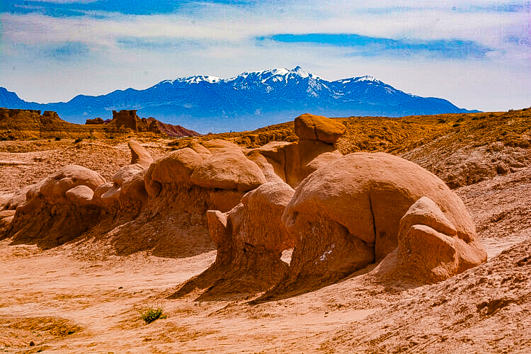
It must be a complete joy staying at the Goblin Valley State Park campground, as the sites are nestled at the foot of these incredible formations. Yurts, tent sites and RV sites are available. All is dry camping.
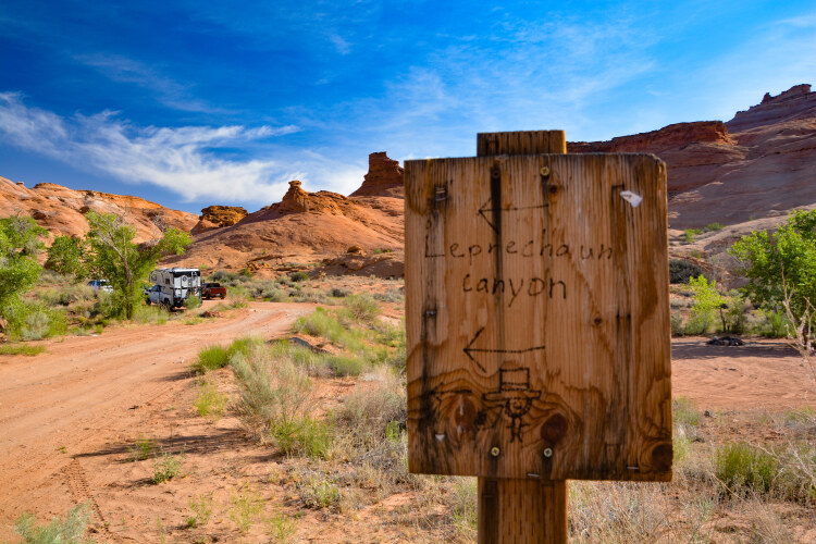
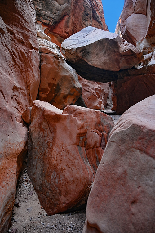
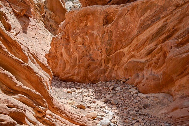
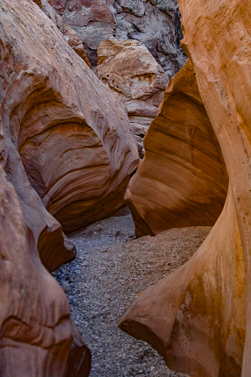
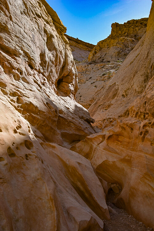
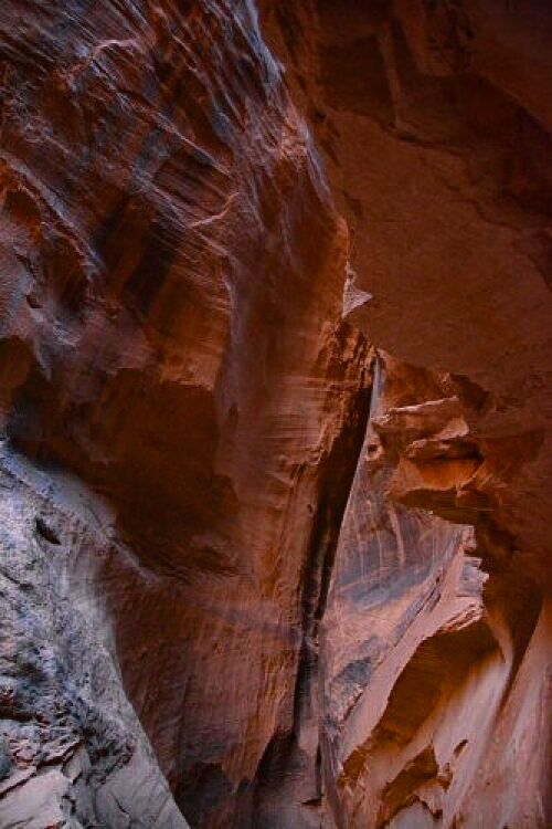
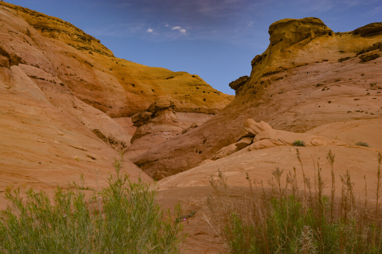
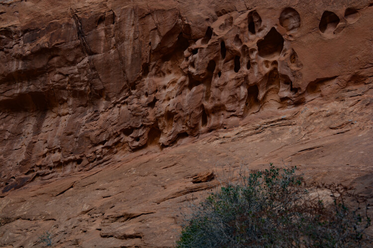
Much needs to be said about the Leprechaun slot canyon. Firstly, the walk to the slot entrance is way, way longer than the slot itself. Secondly, it's pretty difficult to find if you've not been there before. There are no trail markers. Thirdly, this slot is mostly for technical canyoneers. If you don't have the right equipment for rock climbing and scrambling, this one is probably not for you. For those looking for a nice slot stroll, "short" is an understatement. We probably did 6 or 8 "curves" before we realized we were as far as we could go without technical gear, the distance of yards, not miles. And lastly, if you don't fit through the test scale (two vertical bars for which you must fit through sideways), you most likely won't make it past the first curve. It truly is amazingly narrow. And if you ARE an avid canyoneer with all the right gear, you're probably in for a great time. Leprachaun Slot is located on Utah State Highway 95 some 30 miles east of Hanksville. The only signage is the one shown here, on the left side of the road.
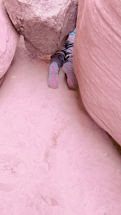
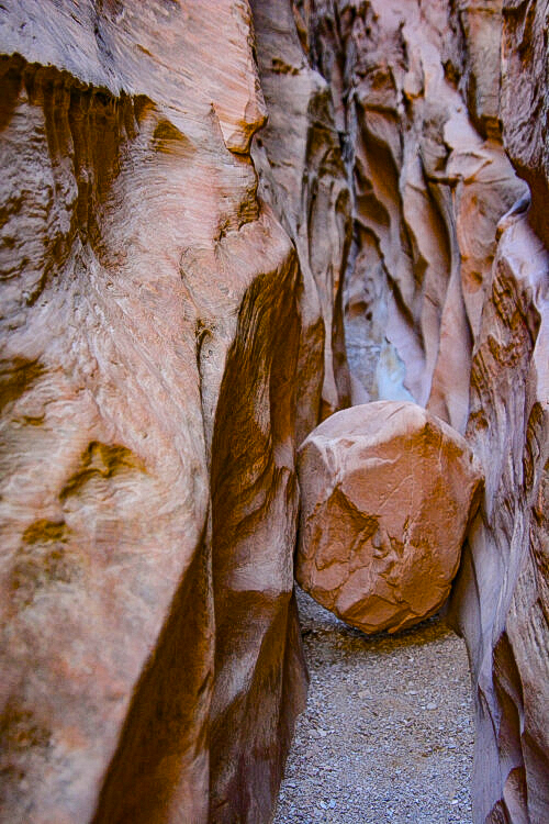
Oh! I forgot to mention the only obstacle once we got inside the slot: this boulder that we couldn't climb over.
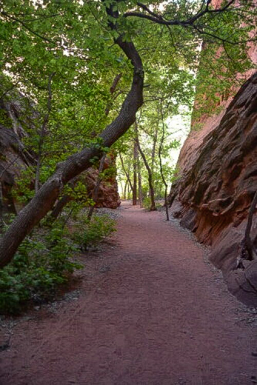
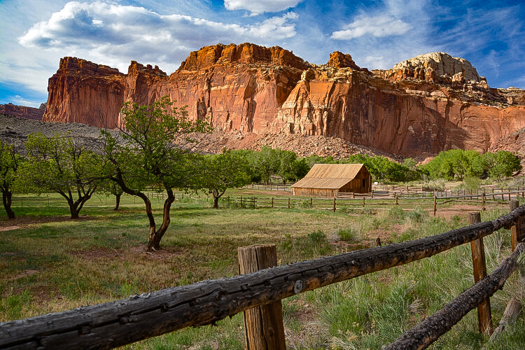
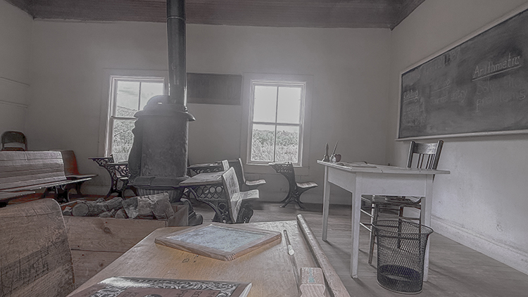
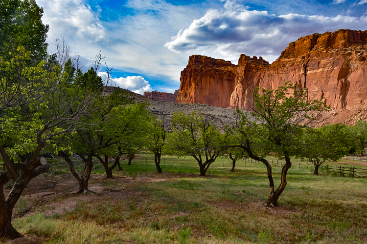
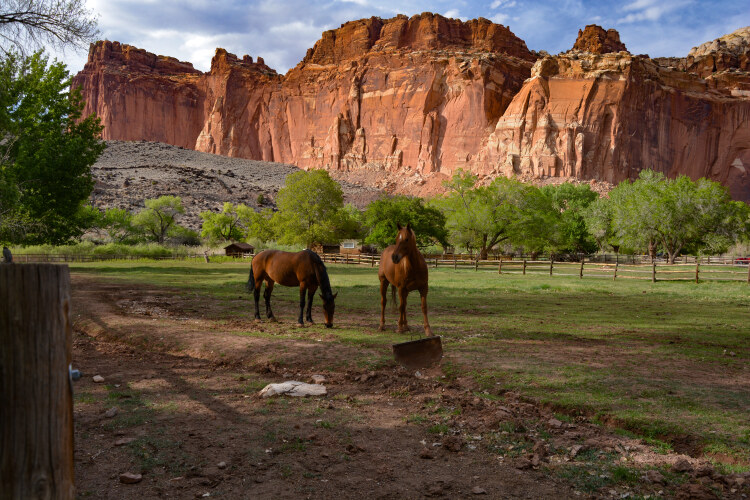
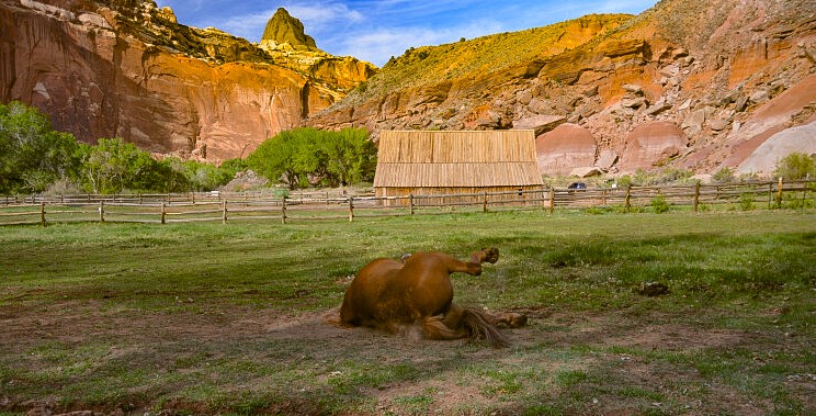
Within Capitol Reef are the remains of a small historic settlement of Mormons that lived in the area before it was a national park. The Mormons were established there in the 1880s and developed an orchard that contained some 2000 fruit trees, hence the name Fruita. By the 1960s, the last of the residents had left as the park gradually bought the land. The Gibbons family were the last to leave, and today a small fenced-in building and a few fruit trees remain. To the left and below are pictures of the Fruita one-room schoolhouse that also acted as a social event hall.

At the Capitol Reef Visitor's Center is the beginning of yet another scenic road, appropriately called Scenic Drive. It wanders off for 8 paved miles in a southeasterly direction and allows witness to more incredible landscape. One big draw is the Grand Wash Road, a side road that is a 1.3-mile dirt-packed road. It stops at a parking lot where Cassidy Arch can be seen and also where the Grand Wash Trail for hiking starts. The landscape along Scenic Drive is stunning, and some pullouts are available for photos.
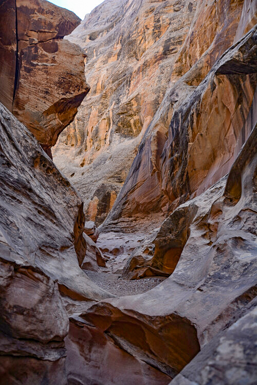
Even though we were disappointed in the slot portion, the outside surroundings are breath-taking.
For our last day, we decided to go back to Capitol Reef. There were a couple of sections we missed going through the first time. One was the historic Fruita community and the other was Scenic Drive.
This is the Grand Wash Road that travels the 1.3 miles to the start of the Grand Wash Trail. The next few photos were taken from that road.
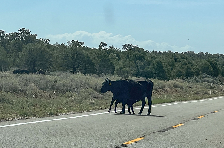
Since Day One, we'd see free-range cattle signage. But it wasn't until the very last hour that we would actually see cattle on the road....literally. Really, Mama? Get your baby off the highway! Photo by K.A.
Thank you for visiting these photo pages.
If you're interested in seeing more, please return to my Main Menu at the bottom of my home page and make your selection.
All images within thewanderingchick.com Web site are copyright protected. They may not be downloaded or otherwise copied.
Please contact me if you think a particular photo or set of photos can be used in your publication.
We finally start our journey back to Arizona, but the remarkable scenic landscape continues. Heading south on Utah's State Highway 95, we cross briefly into the Glen Canyon Recreation Area and then into Bears Ears National Monument. We cross two rivers and Monument Valley, staying on scenic byways all the way into Arizona. Our jouney ends, but the memories will continue forever.
Glen Canyon Recreationi Area, the northern section, off Utah's State Highway 95
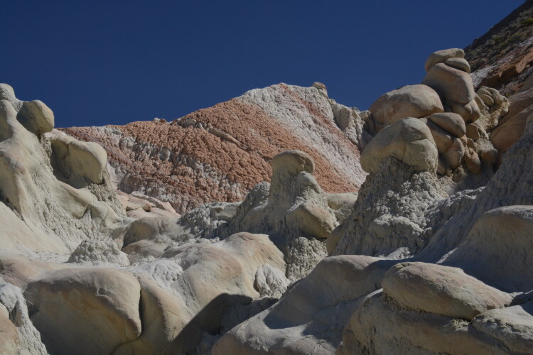
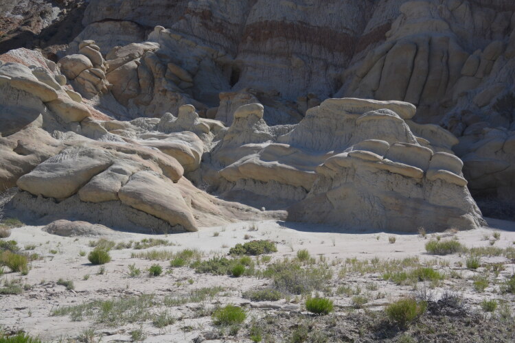
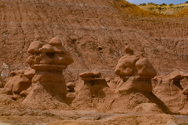
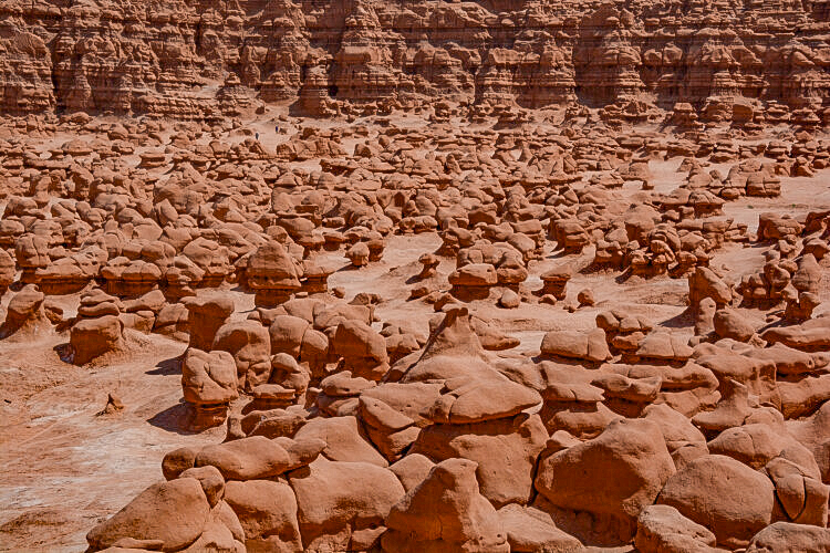
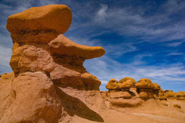
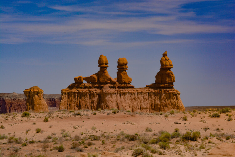
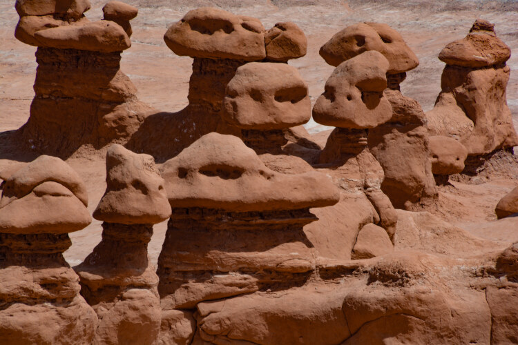
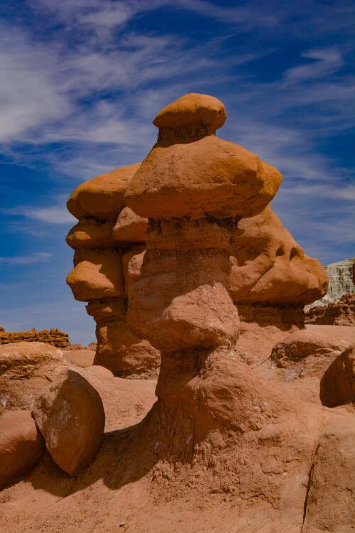
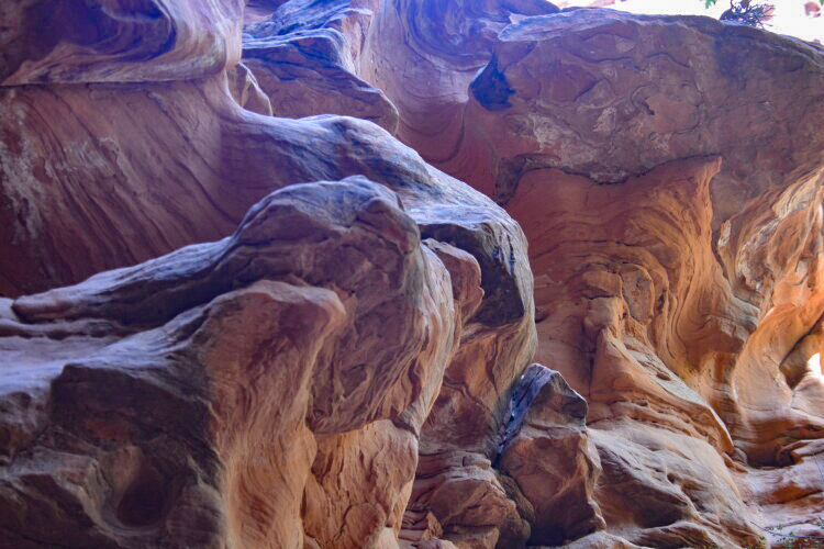
Very near Little Wild Horse slot is the road into Goblin Valley State Park. We spent some time walking down into the maze of mushroom-style structures of red sandstone that were formed millions of years ago by wind and water. The photo above is a stand-alone formation called The Three Sisters, and is an iconic figure not only for Goblin Valley, but well-known throughout Utah.
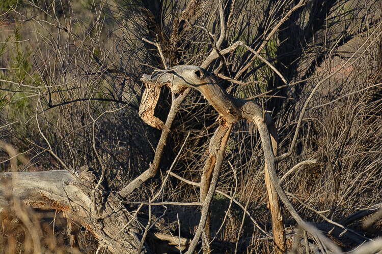
Now I know this may look like just a pile of sticks to most viewers, but somehow I see an image. I think it has legs, but I'm not sure how many. It also seems to have a misplaced eye. Anyway, it captured MY eye, so I photographed it. Simple pleasures.
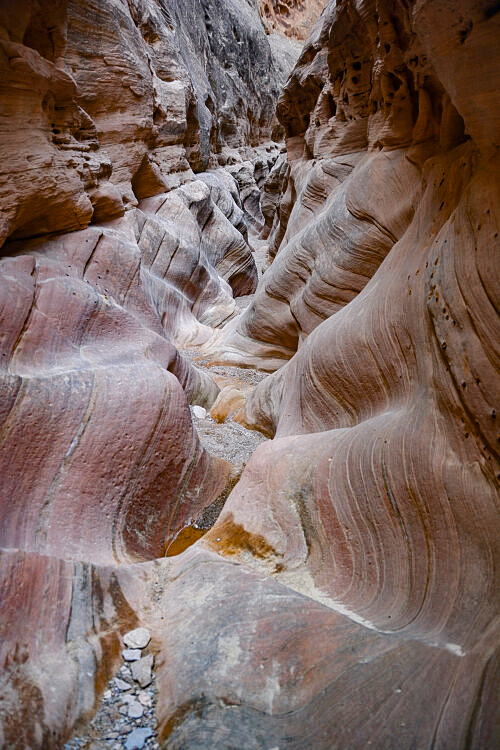
As we continue on Scenic Byway 12, we come to the town of Boulder where there is a cutoff to the Burr Trail Road and Long Canyon Slot. It's a spectacular paved road, and the setting at the slot is charming. The name would make one think the slot itself is a long one, but it was relatively short. And when a slot canyon ends to the point where you can go no further, it's considered a box canyon, as was this one.
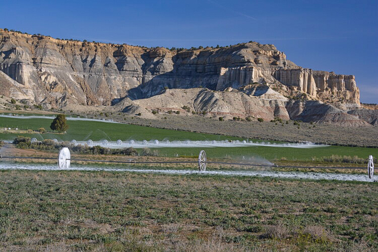
We left Bryce Canyon via Utah State Highway 12 into Henrieville, a rural community of some 200 people. We got a kick out of the frozen irrigation wheels, picturesque in their own right.
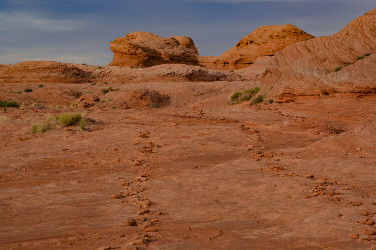
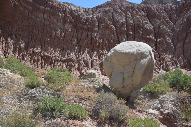
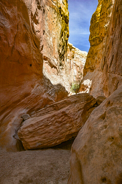
Our next big Grand Staircase adventure, a highlight for both of us, was Devil's Garden on the dirt-packed Hole-in-the-Rock Road. The area is an assortment of geological formations, some in the shape of mushrooms, others are arches and others are just a boulder strategically balanced on top of another boulder.Roaming over, under and around the formations on smooth, hilly slickrock made for even more enjoyment. Hole-in-the-Rock Road is located off Utah State Highway 12 just south of Escalante. Devil's Garden is 12 miles down the road. No dirt roads should be driven in rainy or snowy weather.
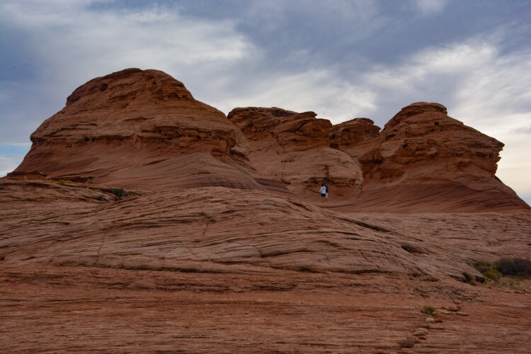
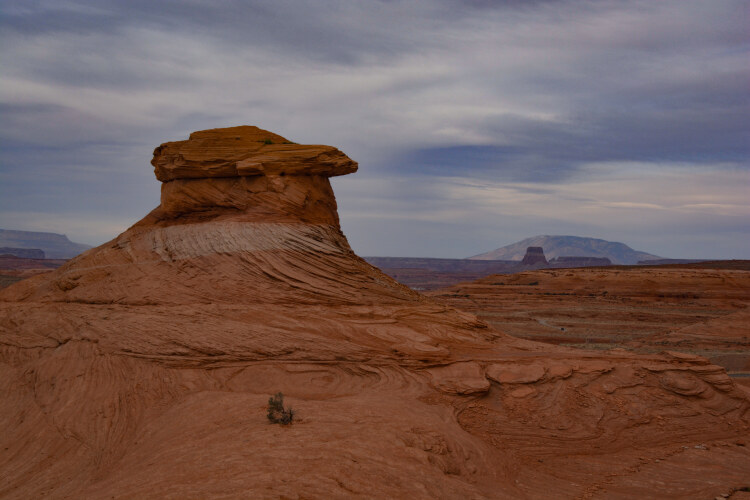
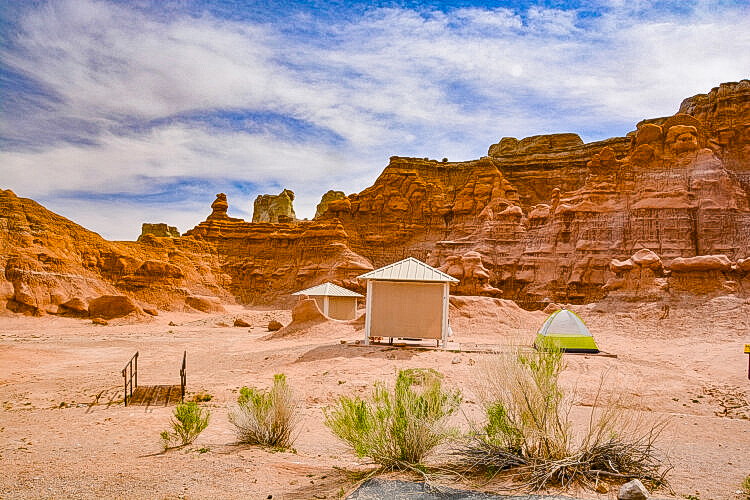
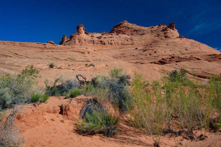
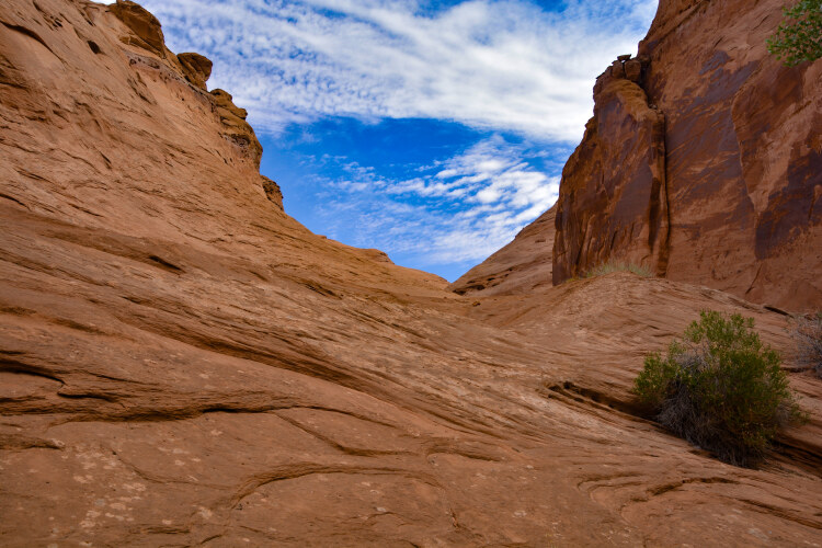
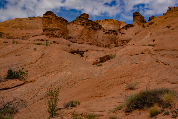
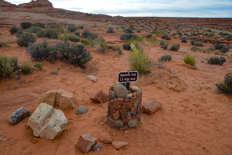
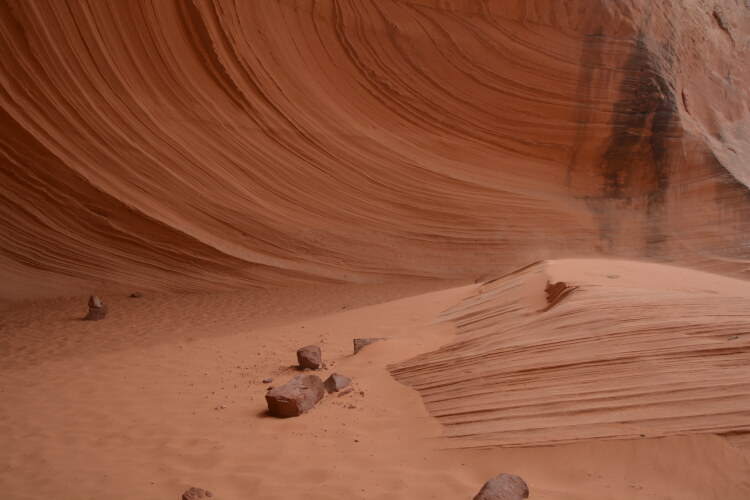
The Beehive Trail is a mile and a half loop, easily hiked across vast slabs of slickrock. The path, lined with the same colored rocks, is easy to follow. The views are stunning. The trail is located on the north side of the Glen Canyon Dam. Turn left at the signs for the Beehive Campground.
.jpg)